Your Pro Guide to Aerial Photography in NZ Construction
Drone photography that proves your progress and wins better construction work.

June 6, 2026

2025-10-29T08:18:16.483Z

Drone photography that proves your progress and wins better construction work.
Ground-level photos don't tell the full story. For construction companies in New Zealand, professional aerial photography isn't a luxury. It's a tool that wins you work. It creates assets that build trust and prove your capability.
For Kiwi builders, standing out is everything. Your work on site might be top-notch, but clients only see what you show them. Ground shots are fine, but they can't capture the scale, progress, or complexity of a job.
Aerial imagery offers a perspective nothing else can. It documents an entire site in a single powerful frame, whether it's a new build in Tauranga or a commercial development in Auckland. This is clear, honest proof of your progress and professionalism.
High-quality aerial shots act as a transparent record of your work. When a client sees a crisp, high-resolution overview of their project developing each week, it answers questions before they're asked. That documentation shows a real commitment to quality and open communication. It turns a simple progress report into a visual story that keeps clients confident.
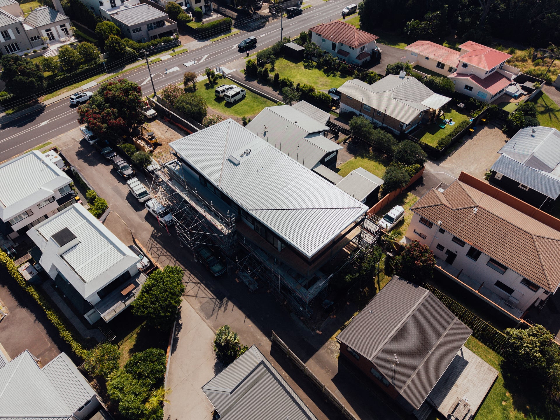
A bird's-eye view cuts through the noise. It gives stakeholders an honest look at site progress, layout, and the surrounding environment, building confidence from day one.
Professional aerial photography gives you practical advantages. Win more contracts: a portfolio of sharp aerial shots showcases the scale and quality of your work in a way ground-only competitors can't match. Improve project oversight: spot site issues like tricky access or drainage problems that are nearly impossible to see from the ground, saving time and money. Create powerful marketing assets: use aerial videos and photos on your website, social media, and tender documents. Enhance client communication: provide clear visual updates that keep clients in the loop and reduce misunderstandings. For construction, this turns an ordinary project into an impressive case study that helps you win the next job.
Flying a drone over a construction site in New Zealand isn't a simple point and shoot job. The Civil Aviation Authority has a serious set of rules. Ignore them and you risk fines, delays, and real safety issues. These regulations protect people and property, which means protecting your business, your clients, and your reputation. This is why hiring a certified and insured professional is non-negotiable. They handle the compliance so you can focus on what the drone delivers.
The CAA has two main rule sets for drones: Part 101 and Part 102. For commercial work on a site, your operator flies under a Part 102 certificate. Part 101 is the learner's permit, for hobbyists and basic jobs. The rules are strict: daylight only, below 120 metres (400 feet), drone in line of sight. For a construction site, that's too restrictive. A Part 102 certificate is the professional standard, issued to operators who have proven solid safety procedures to the CAA. It allows flights over property or near people, which are common needs on a site.
Beyond the rulebook, there's a layer of professionalism around privacy. You can't fly over private property without permission from the owner. On your own site, consent is straightforward. But a drone's camera has a wide view and can easily see into neighbouring properties. A professional operator plans flight paths and frames shots to get the data you need without creeping on the neighbours.
A certified drone operator isn't just a pilot. They're a risk manager, getting the shots you need while following CAA rules and the Privacy Act.
New Zealand's airspace is busy and managed. Any professional providing aerial photography NZ services checks restrictions before they arrive. You cannot fly within 4 kilometres of any aerodrome without clearance from air traffic control. Large areas of controlled airspace, especially around Auckland, Wellington, and Christchurch, require authorisation that only certified operators can handle. And many rural areas have low-flying zones where helicopters operate. When you work with a certified operator, they sort the authorisations and file the safety plans, taking a weight off your shoulders.
Not all drones are equal. The difference between a consumer drone and professional kit is night and day. It's the difference between a hand saw and a drop saw. Both cut wood, but only one delivers the precision a professional job demands. Choosing the right gear isn't about flashy tech. It's about capturing accurate data that helps you manage your project and build your business.
On site, the camera is as important as the drone. A high-resolution sensor is a must. You need to zoom into an image and check a foundation pour or inspect roofing without the picture turning to mush. There's a reason pros fly platforms like the DJI Mavic 3 or Inspire series. They're workhorses, built to stay stable in the gusty conditions common on NZ sites, carrying cameras with large sensors that capture crisp, high-megapixel images.
This detail is crucial, from progress reports to the hero shots that win you work. These are high-quality assets that reflect your own commitment to precision, a concept we explore in our guide to professional architectural photography. A high-resolution image lets you spot a potential issue from your desk, saving a site visit and preventing a small problem becoming a costly one.
Beyond great photos, a professional kit often includes sensors that give a deeper understanding of your site. Thermal imaging can identify heat loss, pinpoint moisture behind walls, or detect overheating electrical components before they fail. On a finished build, it's proof of quality insulation. LiDAR uses laser pulses to create precise 3D models, invaluable for pre-construction surveys, calculating earthwork volumes, and generating as-built models accurate to the centimetre. When a provider offers these, it shows they understand the demands of construction.
Having the gear and your CAA compliance sorted is one thing. The real measure of success is what aerial photography does for you on site. It saves time, makes communication effortless, and helps you build your brand. From breaking ground to final handover, it gives you a clear, unbiased record of your work.
An aerial survey before the first digger arrives is a huge advantage. Using photogrammetry, a drone maps the entire site in high resolution, capturing every contour, noting existing structures, and flagging access issues. This is a data-rich blueprint that helps your team plan with precision and spot headaches early, like an unexpected slope on a steep Queenstown site or tight access in a crowded Auckland suburb. Sorting these on paper, not mid-build, saves time, materials, and money.
The value of seeing a site from above isn't new in New Zealand. Back in the 1950s, archaeologists used aerial photos to spot features like Māori pā sites that were invisible from the ground.
One of the most powerful uses for aerial photography NZ is documenting progress. Regular flights, say every week or fortnight, create an undeniable visual timeline of the build. This sequence is concrete proof of progress for clients and investors. Instead of telling a client the foundations are poured, you send a crisp photo showing a perfectly executed job. That transparency builds serious trust and sets you apart.
A consistent visual record is your best communication tool. It eliminates guesswork and gives stakeholders a clear update that speaks louder than any written report.
A high-resolution overhead view is invaluable for safety inductions. You can clearly point out hazards, no-go zones, and access routes to new contractors before they set foot on site. This same imagery becomes a key asset for your handover packages, giving the client a comprehensive record of their new property, from the roofing down to the landscaping.
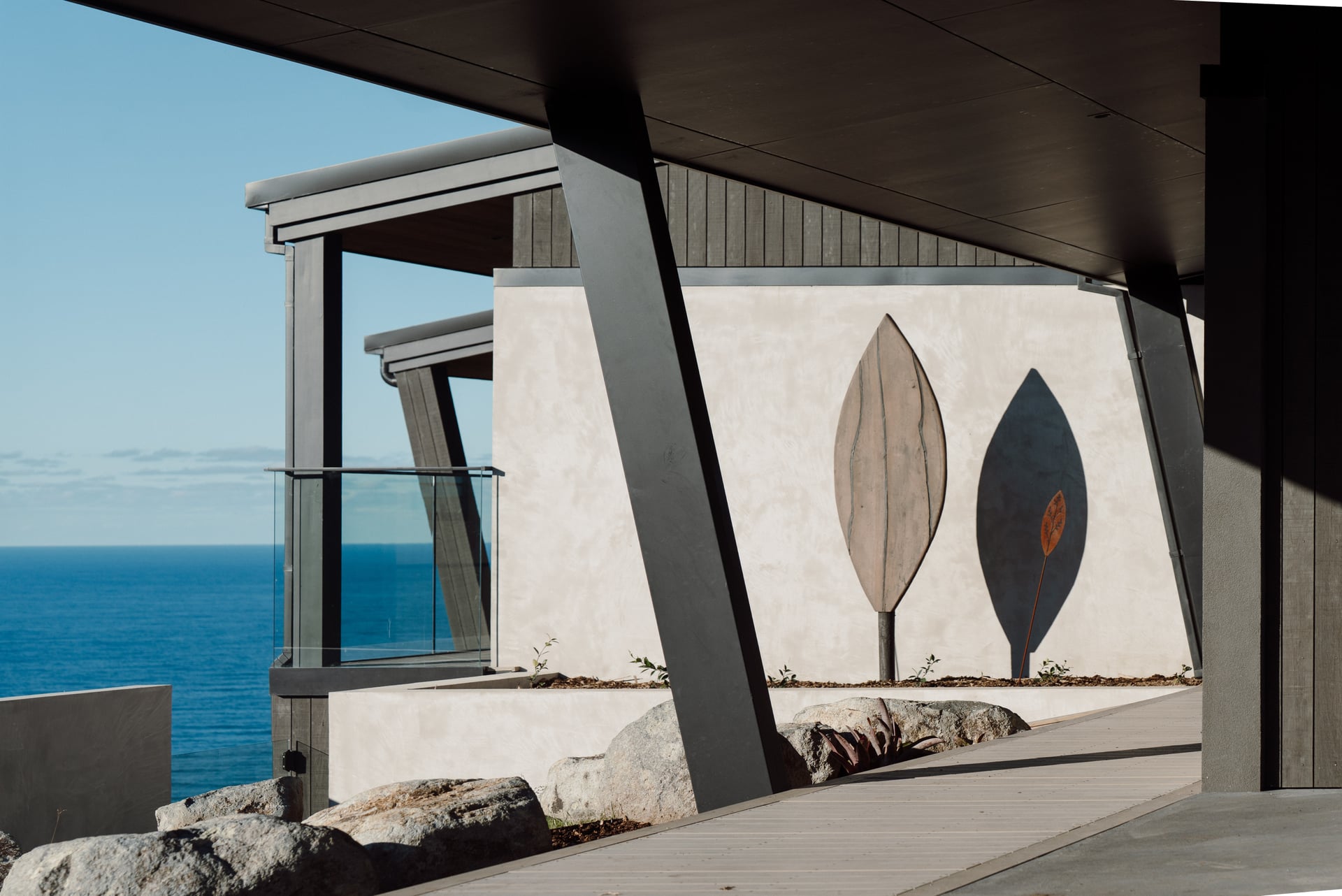
When the job's done, there's no better way to showcase your craftsmanship than with aerial shots. A stunning photo of a finished build, capturing its scale and how it sits in the landscape, is your most powerful marketing tool. These are the hero shots that will dominate your website, social media, and tender documents. They prove your capability in a single glance. We talk a lot about turning projects into powerful stories on the Onsite Media blog, and these images are a core part of that.
Long before drones were common on Kiwi worksites, the view from above was already changing how we saw our country. It has a deep history that shaped how New Zealand was mapped, planned, and built. The goal has always been the same: a clearer perspective of the land you're working with.
It started over a century ago. The first aerial photo in New Zealand was taken in 1919 by a pioneer named George Bolt. The real change came in 1926, when the NZ Air Force flew an aerial survey over the Waimakariri River region. By 1936, a dedicated aerial mapping unit was established, which changed how New Zealand's rugged landscape was documented. You can get a great sense of this work in Te Ara's history of New Zealand mapping.
This early work was transformative for managing the country's land. For the first time, people could see entire river systems, dense bush, and remote coastlines in one picture, mapping landforms and planning infrastructure with accuracy impossible from ground level. Trying to understand a complex site just by walking it is like trying to map the Southern Alps on foot. You only see what's in front of you. An aerial view gives you the whole story instantly. The tools have become powerful and accessible, but the reason we use them hasn't changed: clarity.
Picking an aerial photography partner isn't like hiring any other subbie. You're not just looking for someone who owns a drone. You need a pro who understands the pressures of a live construction site. The right partner delivers more than nice photos. They deliver peace of mind. Get it wrong and you expose yourself to safety risks, low-quality images, and compliance headaches. This is about finding someone who understands the building industry, not just how to fly.
Before you look at a portfolio, a few critical boxes must be ticked. CAA Part 102 certification: ask to see the certificate, your proof they have documented safety procedures and are authorised for complex commercial flights. Public liability insurance: make sure it covers commercial drone operations, and ask for a copy. Construction site experience: ask directly about their work on active sites. A photographer who usually shoots real estate or weddings won't understand the safety protocols of your project. If a potential partner can't show you these, walk away.
Once the essentials are confirmed, look at their work. You're not looking for scenic landscapes. You're looking for proof. Clear progress shots: consistent, well-framed images taken over the life of a single project. Detailed inspection imagery: razor-sharp photos of roofing, cladding, or structural steel. Compelling marketing content: cinematic video and hero shots that make finished projects look incredible. Their ability to supply files in the right formats matters too. If you need help figuring out how this content drives your business, exploring what a dedicated media and marketing agency offers is a smart move.
The cost for professional aerial photography NZ services varies. It's not just flight time. The price reflects the pilot's experience, their gear, CAA certification, and proper insurance. A quick shoot for a new home build might cost a few hundred dollars. A large commercial site needing multiple flights and 3D modelling is a more significant investment. Think of it as an investment, not a cost. The value from tighter project control, great marketing content, and impressed clients almost always outweighs the price.
It can be quick. For most sites, a seasoned operator is in and out fast. A standard progress shoot often takes less than an hour on site. The pilot arrives with a flight plan, runs through safety checks, and gets the shots without getting in your team's way. More involved jobs like a topographic survey or a cinematic shoot take longer, and any good operator will run through the timeframe with you beforehand.
Not much, but a little prep helps. Have a quick tidy-up of the areas you want to feature. Shifting a few utes or a stack of materials blocking a key view makes a difference. The most important thing is communication. Give your operator a clear brief on any must-have shots, maybe a close-up of the new foundations or a wide shot showing the boundaries. Let your crew know when the flight is happening.
If you want your projects to stand out with professional aerial photography and video, book a no obligation call with Onsite Media.
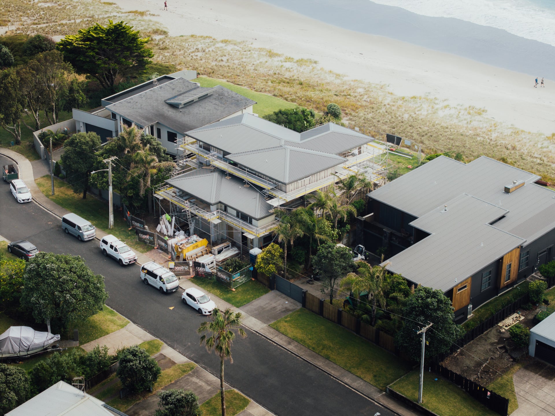
A bird's-eye view gives stakeholders an honest look at site progress, building confidence from day one.